
The Map Kiwi 1 views Claim this Business♡
×-
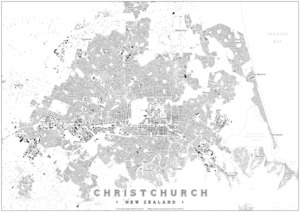
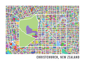 Christchurch Map Artwork Print
$50$45Buy from Store ⊕ More like this 0 0$45.00 –
A colourful map artwork of Christchurch representing individual properties boundaries in a spectrum of colours.
-
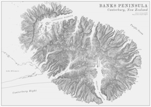 Banks Peninsula Black & White Map
$50$45Buy from Store ⊕ More like this 0 0$45.00 –
A vintage style terrain map of Banks Peninsula in Canterbury, New Zealand.
-
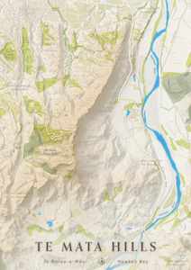 Te Mata Hills, Hawke’s Bay
$50$45$45.00 – Crafted from beautiful high-resolution elevation data of the Hawke’s Bay region in New Zealand’s North Island, this map print shows the iconic ridge of hills that borders the southeast edge of Havelock North. At 399 meters above sea level, Te Mata Peak stands the tallest of these ...Buy from Store ⊕ More like this 0 0 -
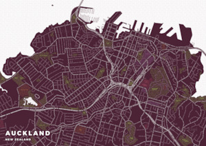 Typography Map of Auckland
$50$45Buy from Store ⊕ More like this 0 0$45.00 –
The Auckland Typography map beautifully represents central Auckland’s streets, motorways, rail lines, parks and more in the flowing text of street names and places.
-
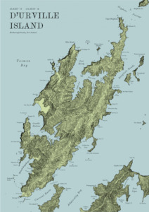 D’Urville Island Terrain Map
$50$45Buy from Store ⊕ More like this 0 0$45.00 –
Terrain Map of D’Urville Island, in New Zealand’s Marlborough Sounds.
-
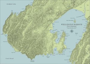 Wellington Harbour Map
$50$45Buy from Store ⊕ More like this 0 0$45.00 –
An artistic map of the bays and islands of Wellington Harbour and the surrounding region, inspired by historical maps and charts.
-
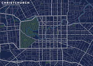 Christchurch Street Typography Map
$50$45Buy from Store ⊕ More like this 0 0$45.00 –
Christchurch’s layout represented beautifully using typography.
-
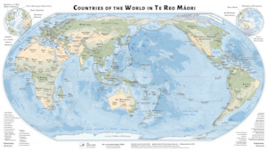 $50Te Reo Māori World MapBuy from Store ⊕ More like this 0 0
A comprehensive world map of country and place names in Te Reo Maori.
In stock
-
 Christchurch Map Artwork Print
$50$45Buy from Store ⊕ More like this 0 0$45.00 –
A colourful map artwork of Christchurch representing individual properties boundaries in a spectrum of colours.
-
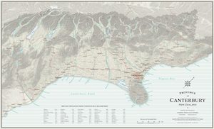 $50Province of Canterbury Antique MapBuy from Store ⊕ More like this 0 0
A beautifully designed map print of Canterbury that draws its inspiration from antique maps.
Printed on demand
-
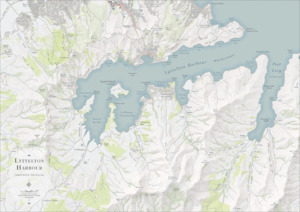 Lyttelton Harbour Topo Map Print
$50$45Buy from Store ⊕ More like this 0 0$45.00 –
This map details the interesting and varied topography of the Lyttelton Harbour basin.
-
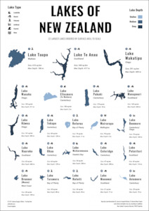 Lakes of New Zealand Poster
$50$45Buy from Store ⊕ More like this 0 0$45.00 – A visual infographical poster of New Zealand’s largest lakes, shown to scale.
-
 Buildings of New Zealand
$50$45Buy from Store ⊕ More like this 0 0$45.00 –
These maps are minimalist and monochromatic, laying bare the urban patterns of growth and structure of each city.
-
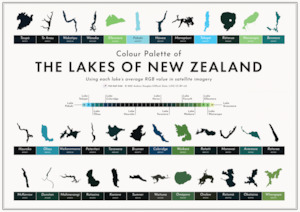 Colours of The Lakes of New Zealand
$50$45Buy from Store ⊕ More like this 0 0$45.00 –
An infographic showing the varied colours of New Zealand, extracted from satellite imagery.
-
 Banks Peninsula Terrain Map
$50$45Buy from Store ⊕ More like this 0 0$45.00 –
A map with a focus on the beauty of Banks Peninsula’s terrain and coastline.
-
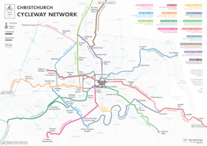
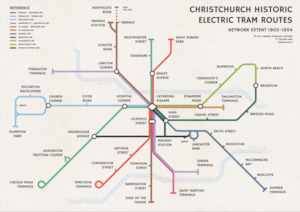 Christchurch Historical Tram Routes Print
$50$45Buy from Store ⊕ More like this 0 0$45.00 –
Network extent map of Christchurch’s electric trams between 1905 and 1954.
-
 $50Te Reo Māori Map of Aotearoa/New Zealand PrintBuy from Store ⊕ More like this 0 0
A map print showing the Te Reo Māori names of towns and cities across Aotearoa/New Zealand. A fantastic resource for learning more about New Zealand places from a uniquely Te Reo perspective.
-
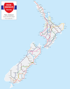 New Zealand State Highway Metro Map Print
$50$40Buy from Store ⊕ More like this 0 0$40.00 –
New Zealand’s State Highways as you’ve never seen them before, re-imagined in the classic style of the London Underground tube map. Choose from a range of different print sizes and locations below.
-
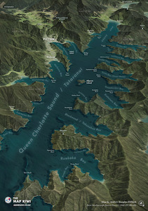 Queen Charlotte Sound / Tōtaranui
$50$45Buy from Store ⊕ More like this 0 0$45.00 –
A 3D perspective of the upper reaches of Queen Charlotte Sound / Totaranui.
-
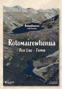 Blue Lake Vintage Poster
$50$45Buy from Store ⊕ More like this 0 0$45.00 –
A vintage-style poster of Rotomairewhenua / Blue Lake in Nelson Lakes National Park.
-
-
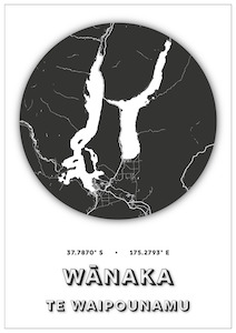 Wanaka Map Dot
$50$45Buy from Store ⊕ More like this 0 0$45.00 –
Minimalistic designs of New Zealand cities and places with names in both English and Te Reo Māori.
-
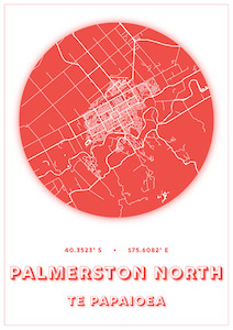 Palmerston North Map Dot
$50$45Buy from Store ⊕ More like this 0 0$45.00 –
Minimalistic designs of New Zealand cities and places with names in both English and Te Reo Māori.
-
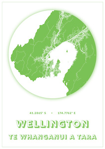 Wellington Map Dot
$50$45Buy from Store ⊕ More like this 0 0$45.00 –
Minimalistic designs of New Zealand cities and places with names in both English and Te Reo Māori.